
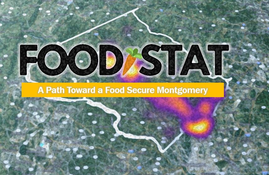
Navigating Toward Food Security with FoodStat
Many of us use navigation devices like Garmin, or web-based apps like Google Maps or Ways, to locate a new restaurant, find the shortest or quickest route between two places, or just find the closest gas station to our current location. These mapping tools have transformed the way we research and navigate our world geographically. Now Montgomery County has created FoodStat. It’s an easy-to-use, interactive data analysis website to help us reach our goal of everyone in Montgomery having access to healthy, affordable food.
The Montgomery County Food Council, Manna Food Center, the Capital Area Food Bank, and the Montgomery County Department of Health and Human Services collaborated with Office of the County Executive staff to create this online platform.
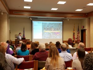
Thomas Tippett, CountyStat Analyst unveils FoodStat interactive analysis tool to those engaged in food security.
FoodStat is the first specific application of Montgomery County’s larger database, called CountyStat. FoodStat uses more than 60 indicators of vulnerability and need in our county. The data can be viewed as map layers grouped into six main categories: boundaries, community assets, retail food, food assistance providers, transportation access, and demographics.
Heather Bruskin, Executive Director of the Food Council, explains how FoodStat will be used. “We hope that FoodStat will enable government agencies, food assistance providers, and any other interested parties to analyze the community’s access to food, its transportation and infrastructure needs, high-priority zones and service delivery gaps.”
“We’re excited to use FoodStat for Community Food Rescue,” Cheryl Kollin, CFR’s Program Director, says. “Overlaying data provides a powerful analysis and visualization tool. For example one map displays the percentages of residents that are estimated to be food insecure, and we can pair it with locations of farmers markets as sources of potential fresh produce donations.” CFR currently picks up from the Olney Farmers Market and the Kentlands Mainstreet Market and seeks others. FoodStat will help CFR target communities and potentially match donated surplus produce left after the farmers markets with nearby food assistance providers.
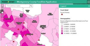
Overlaying data layers of % population estimated to be food insecure with nearby farmers markets helps CFR target and match sources of recovered food with communities in need.
To make FoodStat an even more valuable resource for food recovery and redistribution, CFR hopes to link it with the data from CFR’s Chowmatch matching tool. In tech geek speak, this would be an Application Programming Interface (API), which would allow FoodStat to add and automatically update data layers showing the ChowMatch network and food runs. For example, with this capability, we could overlay FoodStat’s map of food businesses that offer culturally-appropriate food with a ChowMatch data layer displaying CFR food assistance providers nearby that seek these types of food donations. Then we can focus our outreach efforts on recruiting these businesses in proximity to where this food is most needed. Having ChowMatch’s data layers linked to FoodStat will hopefully raise CFR’s visibility, show our stakeholders the value that CFR brings to the county and help us expand our network.
FoodStat drills down into local data, which supplements national food insecurity data that the non-profit, Feeding America, publishes at state and county levels. For other U.S. communities that don’t have access to local, interactive mapping, the Environmental Protection Agency’s (EPA) newly released Excess Food Opportunities Map identifies more than 500,000 potential generators of excess food nationwide, such as correctional facilities, educational institutions, healthcare facilities, hospitality industry, food manufacturers and processors, and food wholesalers and distributors. It also identifies more than 4,000 potential recipient organizations that divert wasted food from landfills for re-distribution to people, composting, or anaerobic digestion. Visit the EPA website to learn more about the map, and to access a user guide and the technical methodology.
In the world of food security, FoodStat is a great navigational tool. Looking at the big picture, Bruskin sums up, “we hope that FoodStat will lead to the creation of policies and strategies that will inform priorities, drive collective impact, and ultimately reduce food insecurity in Montgomery County.”